 Day Trips from Sapporo
Cape Peshi on Rishiri Island: A 23-Minute Climb to the Best View of the Harbor and Mt. Rishiri
 By Chaporo, a Sapporo local Published
Quick answers
- 23 minutes from the trailhead to the top on the gentle route
- No parking at the trailhead: park at the Oshidomari ferry terminal and walk 5 to 10 minutes
- The steep route is rough and very windy near the top; take the gentle route if unsure
- Open May to October until the snow; wear sneakers
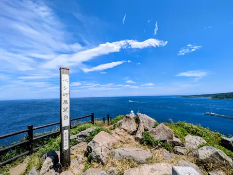
From the top of Cape Peshi you look straight down on Oshidomari harbor, with Mt. Rishiri filling the sky behind it, and when you turn around there is nothing but sea. It is a rocky hill about 90 m high beside Rishiri Island's ferry port, where the ferry from Wakkanai on the Hokkaido mainland comes in, and it is the place I'd most recommend on the island. I climbed it in June 2026; from the trailhead to the top took 23 minutes.
How long does it take to climb Cape Peshi?
From the trailhead, the path climbs to a fork, where it splits into a steep shortcut and a longer, gentler route (the signs call them the time-saving steep course and the roundabout gentle course).
| Section | How long it took me |
|---|---|
| Trailhead to the fork | 15 minutes |
| Fork to the top on the gentle route | 8 minutes |
| Fork to near the top on the steep route | 6 minutes |
On the gentle route, it was 23 minutes from the trailhead to the top. I went up the steep route, turned back just below the top, then climbed the gentle route instead and spent 5 to 10 minutes at the top; from leaving the parking lot to getting back took me about an hour. Up and down the gentle route alone is quicker. It isn't long, and for me, in my thirties, it was just enough to get a little out of breath.
You can climb from May to October, until the snow comes. Parts of the trail are narrow and steep, and the island's tourism site warns it is dangerous in bad weather (Rishiri Plus, as of November 2026). I climbed in a thin long-sleeved running top and sneakers. Even the gentle route has rough footing in places, so shoes matter most.
Where to park for Cape Peshi
There's no parking near the trailhead. I parked at the Oshidomari ferry terminal and walked 5 to 10 minutes to the start.
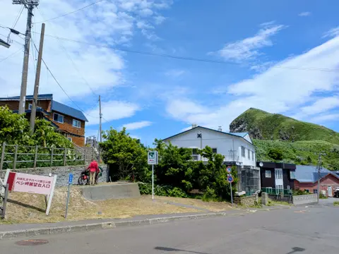
Across from the ferry terminal is Isoyakitei, which serves raw sea urchin bowls. After coming down from the cape, I left the car where it was and walked in for lunch.
 Rishiri Uni (Sea Urchin): When It's in Season, What It Costs and Where to Eat ItWhen sea urchin is in season on Rishiri Island, what a raw sea urchin bowl cost on the day I went, and how it compares with opening a live sea urchin yourself at Kamui Kaigan Park, from a Sapporo local.
The two routes up Cape Peshi
The first 15 minutes, from the trailhead to the fork, are a paved, gentle slope; I didn't get out of breath.
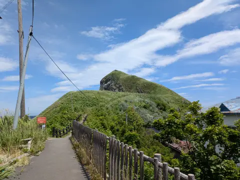
At the fork the path splits: the gentle route goes right and the steep route goes left, and there is a sign with a map of both.
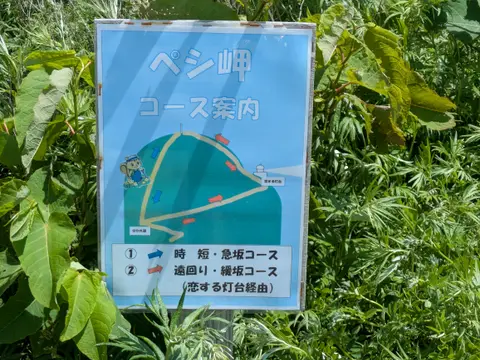
The gentle route
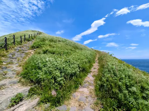
I reached the top on the gentle route. The slope is easy and the path is easy to walk, though it is unpaved and rocky in places.
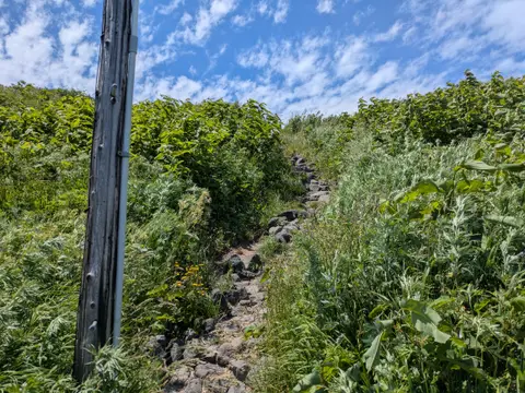
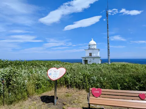
On the way you pass Oshidomari Lighthouse, nicknamed the Lighthouse of Love.
The steep route
The steep route was all jagged rock, hard to walk and very steep. Near the end I was climbing with my hands on the ground.
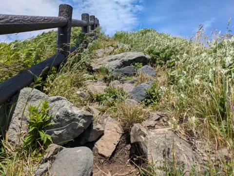
There is a handrail on the slope side for part of the way, but it stops near the top. Nothing blocks the wind there, and it was so strong I thought my glasses would blow off. Fear won, and I couldn't do the last few meters without the rail, so I went back down to the fork. It was a thrill for me, but it is genuinely dangerous: even when the wind was light at the bottom, it was strong near the top. Take care if you go this way.
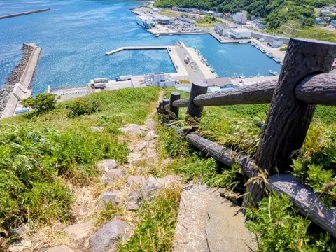
The view from the top of Cape Peshi
From the top, Oshidomari harbor is at your feet and Mt. Rishiri stands beyond it.
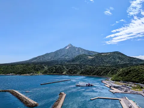
The other side is open sea. The contrast of the harbor and the mountain, and all that sea, made this the place I'd most recommend on Rishiri.
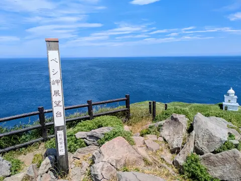
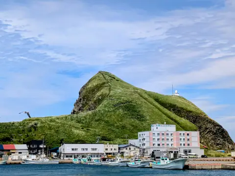
Cape Peshi also goes by Lighthouse Hill and Gorilla Rock (Rishiri Plus, as of November 2026). I think the Gorilla Rock name comes from its shape seen from the ferry terminal, which looks like a gorilla's head.
FAQ about Cape Peshi
Q1. Is there parking at Cape Peshi?
Not near the trailhead. Park at the Oshidomari ferry terminal and walk 5 to 10 minutes to the start.
Q2. How long does Cape Peshi take?
The gentle route took me 23 minutes from the trailhead to the top. Allow an hour from the ferry terminal parking lot and back.
More on Rishiri Island
I climbed Cape Peshi on my second day, after Yuhigaoka Viewpoint, a hill looking over Oshidomari, and before a sea urchin bowl for lunch. Here is the whole two-night drive with times and costs.
Rishiri Island Itinerary: 2 or 3 Days Around Mt. Rishiri by Rental CarA Sapporo local's Rishiri Island itinerary by rental car, with real times: flights from Sapporo, picking up the car at the airport, Himenuma Pond, Cape Peshi, sea urchin season and prices, where to stay, costs, and a shorter 1-night version.