 Day Trips from Sapporo
Cape Soya: The Northernmost Point of Japan and the View to Sakhalin
 By Chaporo, a Sapporo local Published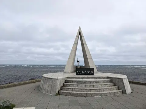
Quick answers
- The Monument of the Northernmost Point of Japan stands at the water's edge
- Sakhalin in Russia is 43 km away and visible on clear days
- About 40 minutes by car from Wakkanai Station or 25 minutes from Wakkanai Airport; free car park with toilets
- Cold, strong wind even in August: bring a warm jacket
Cape Soya, in Wakkanai, is the northernmost point of Japan's main islands. A triangular monument marks the spot at the water's edge, the Sea of Okhotsk spreads out in front of you, and on a clear day you can see Sakhalin in Russia, only 43 kilometers away. It is free, the car park is right at the cape, and it is the goal of many road trips up the coast from Sapporo.
What is at Cape Soya?
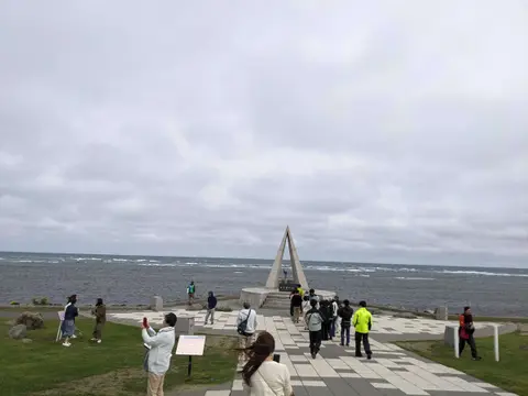
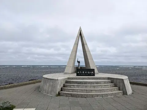
The centerpiece is the Monument of the Northernmost Point of Japan, a tall triangle on a round base right by the sea, and almost everyone stops for a photo with it. Around the cape there are other monuments, including a statue of Mamiya Rinzo, the explorer who mapped Sakhalin. Look out across the water: on a clear day the outline of Sakhalin sits on the horizon. When I was there it was cloudy and Sakhalin stayed hidden, which is common, so do not be too disappointed if you miss it.
Allow 20 to 30 minutes for the monuments, photos and a look at the sea.
How cold is Cape Soya?
Colder than you expect. The cape sticks out into the sea, and even in August a cold wind blows hard, so bring a proper jacket in every season.
How to get to Cape Soya
Cape Soya is about 40 minutes by car from Wakkanai Station and about 25 minutes from Wakkanai Airport, along the coast road east of the city. From Sapporo, Wakkanai is over 300 kilometers away, about five and a half to six hours without stops, so stay a night in Wakkanai and go in the morning.
The car park is free and holds 72 cars, with toilets. There are souvenir shops and places to eat across the road from the monument.
Near Cape Soya
In the Soya Hills just south of the cape, the White Road runs for about 3 kilometers, paved with crushed scallop shells, through green hills with the sea beyond; it is a short drive and well worth adding. Back in Wakkanai, Cape Noshappu on the west side of the city is the place for the sunset over Rishiri and Rebun islands, and for dinner, try octopus shabu-shabu, the local specialty.
My Sapporo to Wakkanai route takes the Ororon Line, the coast road along the Sea of Japan, and ends at Cape Soya and the White Road.
 Sapporo to Wakkanai by Car: The Ororon Line Coast Road to Cape SoyaDriving from Sapporo to Wakkanai up the Ororon Line, the Sea of Japan coast road, from a Sapporo local who did it: the stops, the closest view of Rishiri Island, sunset at Cape Noshappu, and Cape Soya and the White Road the next morning.
FAQ about Cape Soya
Q1. Can you see Russia from Cape Soya?
On a clear day, yes. Cape Crillon on Sakhalin is about 43 kilometers away, and you can see the island's outline across the Soya Strait.
Q2. How do you get from Wakkanai to Cape Soya?
About 40 minutes by car from Wakkanai Station, or 25 minutes from Wakkanai Airport. There is a free car park at the cape.
Q3. Is Cape Soya the northernmost point of Japan?
It is the northernmost point of Japan's main islands, and the monument marks it.
Q4. Is there a fee at Cape Soya?
No. The cape and the car park are free.
Q5. What should I wear to Cape Soya?
A warm jacket, even in summer. The wind off the sea is cold and strong.