 Day Trips from Sapporo
Sapporo to Wakkanai by Car: The Ororon Line Coast Road to Cape Soya
 By Chaporo, a Sapporo local Published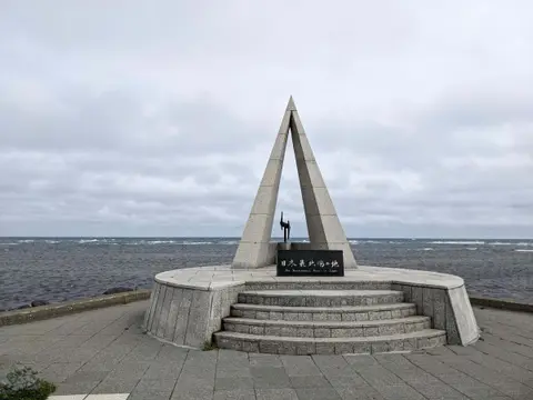
Quick answers
- Over 300 km from Sapporo: 5.5 to 6 hours direct, a full day along the coast with stops; stay at least one night
- Best stops: herring soba at Obira, the Otonrui wind farm, the Sarobetsu Wetland and the Yukuru view of Rishiri Island
- Cape Soya is 40 minutes from Wakkanai Station; Sakhalin in Russia is 43 km away and visible on clear days
- Bring a warm jacket even in August, and drive it between May and October
Wakkanai is the end of the road in Japan: the northernmost city, with Cape Soya, the northernmost point of the main islands, 40 minutes beyond it and Russia's Sakhalin on the horizon. I drove there from Sapporo up the Ororon Line, the coast road along the Sea of Japan, stopping for herring soba, a line of giant wind turbines and the closest view of Rishiri Island, and arrived at Cape Noshappu in time for the sunset. This guide is that drive, with the second morning at Cape Soya and the White Road.
Is Wakkanai worth visiting?
Yes, if you like long drives and wide, empty landscapes. The reason to go is less the city itself than the journey and the edge-of-the-map feeling: the coast road with almost nothing built on it, Rishiri Island's volcano rising out of the sea, sunset over the water at Cape Noshappu, and standing at Cape Soya looking toward Russia.
It is far, so it is not a day trip. Plan at least one night in Wakkanai.
How far is Wakkanai from Sapporo?
By road it is over 300 kilometers. Going straight there takes about five and a half to six hours; my drive along the coast, with stops for lunch, viewpoints and a wetland walk, took about 11 hours, leaving Sapporo at 8:00 and reaching Cape Noshappu at about 18:10.
| Way to go | Time from Sapporo | Good for |
|---|---|---|
| Car along the Ororon Line | A full day with stops | The coast, the viewpoints and the freedom to stop |
| Limited express Soya (train) | About 5 hours 10 minutes | Wakkanai city only; you need a car or bus for the capes |
| Flight to Wakkanai Airport | About an hour in the air | Short trips; rent a car at the airport |
To make the day work, I took the expressway from Sapporo to Rumoi and drove the coast from there. If you want a shorter taste of the Ororon Line, the stretch from Ishikari to Rumoi and Mashike makes a day trip from Sapporo.
The Ororon Line
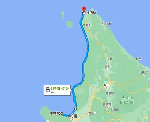
The Ororon Line is the nickname for the roads that run up the Sea of Japan coast from Otaru to Wakkanai, about 320 kilometers, mostly Routes 231 and 232. North of Rumoi the towns thin out, the road straightens, and the sea is on your left for hours. It is an easy road to drive, and there are roadside stations every hour or two for toilets and food. The name comes from the ororon bird, the common murre, a seabird that in Japan breeds only on Teuri Island off this coast.
My route from Sapporo to Wakkanai
| Time | Stop |
|---|---|
| 8:00 | Leave Sapporo |
| 10:30–11:00 | Roadside Station Rumoi |
| 11:30–12:30 | Roadside Station Obira Nishin Banya (lunch) |
| 13:05–13:10 | Ororon bird monument |
| 13:45–14:10 | Roadside Station Enbetsu Fujimi |
| 14:45–14:50 | Sarobetsu Plain parking and the Otonrui wind farm |
| 15:15–15:40 | Sarobetsu Wetland Center |
| 16:05–16:15 | Yukuru viewpoint |
| 16:50–18:00 | Dinner at Urokotei |
| 18:10–18:30 | Cape Noshappu at sunset |
| 19:00 | Hotel Meguma |
Roadside Station Rumoi
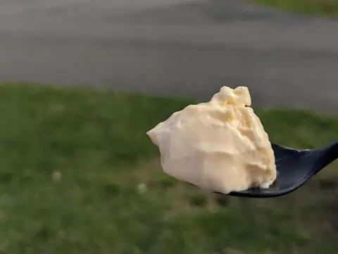
The first break, two and a half hours from Sapporo. Rumoi is known for herring roe and herring, and the herring simmered in sweet soy sauce is a good souvenir. The station is also known for its "too firm pudding," sold from a vending machine: firm on the outside and fluffy, almost like a soufflé, inside.
Roadside Station Obira Nishin Banya
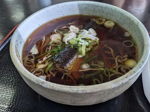
Obira grew rich on herring fishing, and next to this roadside station is the old Hanada family fishery house, the northernmost Important Cultural Property in Japan. The restaurant serves herring dishes. I had the herring soba: the fish simmered until it falls apart in the broth, perfect with the noodles.
The Ororon bird monument
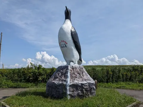
In Haboro, a 7.5-meter statue of the ororon bird stands by the road. There are two, one at each end of town; the northern one has a small parking space for four or five cars, so it is easy to stop for a photo.
Roadside Station Enbetsu Fujimi
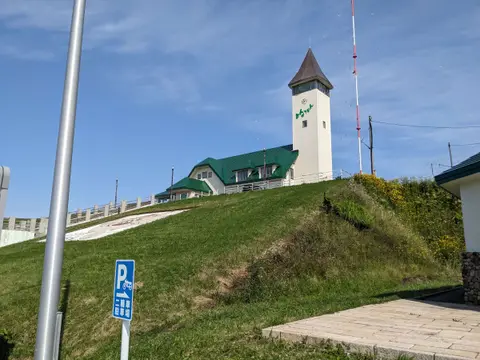
"Fujimi" means "Fuji view," and on a clear day the lookout on the hill behind this roadside station shows Rishiri Fuji, the volcano on Rishiri Island, across the sea. The restaurant serves local seafood, and the scallops from Enbetsu are especially sweet.
Sarobetsu Plain and the Otonrui wind farm

North of Teshio, the road runs past 28 wind turbines standing in a line beside it. From the Sarobetsu Plain parking area you can watch them turning right above you; the wind here is strong, and the scale is overwhelming. On a clear day you can also see Rishiri and Rebun islands across the sea. The current turbines are scheduled to run until March 2027, after which the wind farm is to be rebuilt.
Sarobetsu Wetland Center
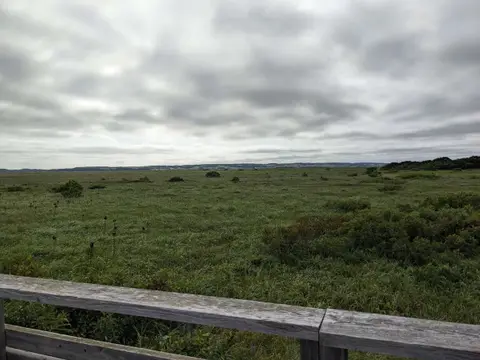
The Sarobetsu Wetland is the largest raised bog in Japan, and from the visitor center a 1-kilometer boardwalk goes out into it, so you can see the plants up close. I went in summer, when it was green all the way to the horizon; in autumn it turns red and gold. The center is open from 9:00 to 17:00 from May to October and from 10:00 to 16:00 in winter, closed on Mondays.
Yukuru viewpoint: the closest view of Rishiri Island
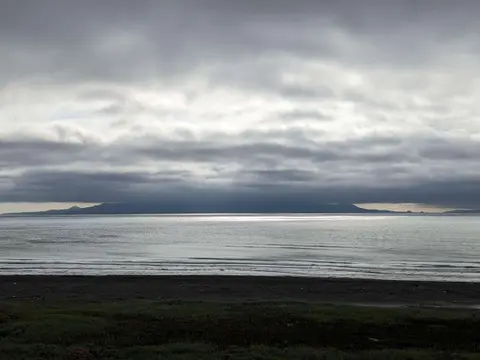
Yukuru is the point on the Ororon Line closest to Rishiri Island. It is only a parking space for about five cars and easy to miss, but facing north you have the sea and the islands of Rishiri and Rebun on your left and the wetland on your right, with almost nothing man-made in sight.
Dinner at Urokotei
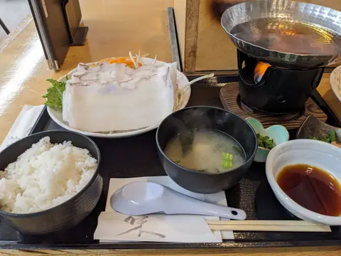
In Wakkanai, Urokotei faces the port and serves seafood, but the dish to order is Wakkanai's specialty, octopus shabu-shabu. The giant Pacific octopus is sliced thin and swished briefly through hot broth, so it stays tender instead of chewy.
Cape Noshappu at sunset
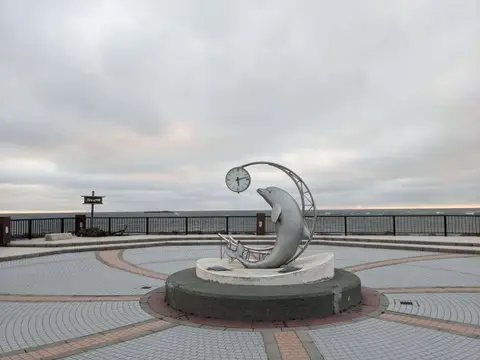
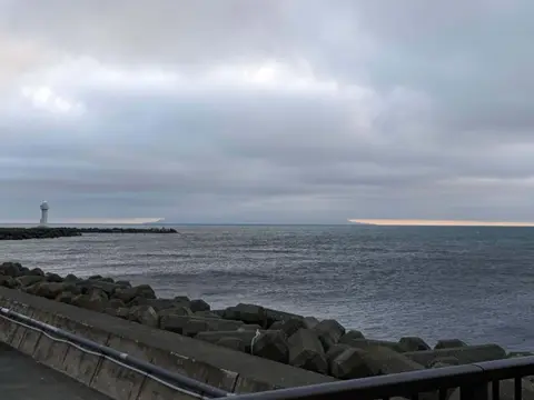
Cape Noshappu, in the northwest of Wakkanai, is the end of the Ororon Line. From here you can see Rishiri and Rebun islands and the outline of Sakhalin, and above all the sun setting into the sea. The sun sets at about 19:00 to 19:25 in July and 18:15 to 19:00 in August, so plan your arrival around it. Even in August the wind here is cold, so bring a jacket.
Hotel Meguma
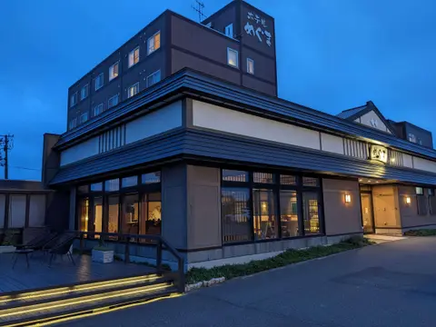
I stayed at Hotel Meguma, a little outside the center and very quiet. Its baths include the clear, smooth Wakkanai Onsen water and an outdoor bath, and there is a Finnish sauna where you can pour your own water on the stones. Dinner was local seafood, such as scallop sashimi and Rishiri kelp, and my room looked out over the sea toward Cape Noshappu.
The next morning: Cape Soya and the White Road
Cape Soya: the northernmost point of Japan
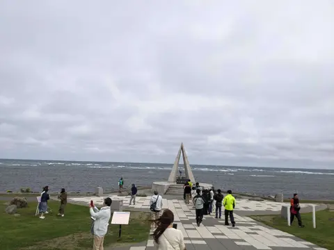
Cape Soya is the northernmost point of Japan's main islands, about 40 minutes by car from Wakkanai Station. The triangular Northernmost Point of Japan monument stands at the water's edge, and everyone takes their photo with it. The Sea of Okhotsk spreads out in front of you, and Cape Crillon on Sakhalin, in Russia, is only about 43 kilometers away, so on a clear day you can see the island. On my visit it was cloudy and Sakhalin stayed hidden. The car park is free, with room for about 70 cars.
The White Road
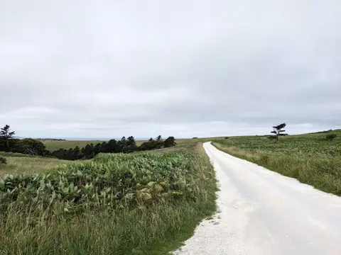
In the Soya Hills just south of the cape, the White Road runs for about 3 kilometers, paved with crushed scallop shells from Wakkanai's fishing industry. The white road cutting through the green hills, with the sea beyond, is one of the most unusual views in Hokkaido.
You can drive it, but it is narrow and the start is hard to find, so check the directions on the Wakkanai tourism site first. The city asks visitors to enter from the Cape Soya end, use the toilets at the cape first, drive slowly and give way, never walk into the pasture, and drive slowly through the village at the end. There is no car park; stop only in the passing places.
Weather and clothes
Even in summer, Wakkanai is cool and windy: in August the temperature can stay below 20°C. When I went in August, a cardigan was not nearly enough at Cape Noshappu and Cape Soya. Bring an autumn jacket, or a winter one if you feel the cold.
The best time to drive the Ororon Line is May to October. From November to April the coast is extremely windy, and when it snows there is a real risk of whiteouts, especially on Route 106 between Teshio and Wakkanai, which runs past the wind farm with nothing to break the wind. If you go in winter, check the weather and road conditions carefully.
 Driving in Hokkaido: A Local's Guide to Renting a Car and the RoadsHow to rent a car and drive in Hokkaido, from a Sapporo local who drives every week: the license you need, expressway tolls and the Hokkaido Expressway Pass, road rules, and winter driving.
FAQ about driving to Wakkanai and Cape Soya
These are the questions people most often ask.
Q1. How far is Wakkanai from Sapporo by car?
Over 300 kilometers, about five and a half to six hours without stops. Along the Ororon Line with stops for lunch and viewpoints, plan a full day.
Q2. Can you see Russia from Cape Soya?
On a clear day, yes. Sakhalin is only about 43 kilometers away, and you can see its outline across the Sea of Okhotsk.
Q3. How do you get from Wakkanai to Cape Soya?
About 40 minutes by car from Wakkanai Station, or about 25 minutes from Wakkanai Airport. There is a free car park at the cape.
Q4. What is the Ororon Line?
The nickname for the coast road along the Sea of Japan from Otaru to Wakkanai, about 320 kilometers, mostly Routes 231 and 232.
Q5. When is the best time to visit Wakkanai?
May to October, for easy driving. Even then, bring a warm jacket; it is often below 20°C in August. In winter the coast road can have strong winds and whiteouts.
Q6. Can I do Wakkanai as a day trip from Sapporo?
No. It is too far; stay at least one night in Wakkanai.