 Day Trips from Sapporo
Where to See Mt. Yotei: A Local's Guide to the Best Viewpoints by Car
 By Chaporo, a Sapporo local Published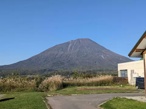
Quick answers
- Best classic view: Aikawa Viewpoint Parking, where a straight road runs toward the mountain
- Also worth it: the reflection in the pond at Noka no Sobaya Yoteizan and the open-air bath at Makkari Onsen (600 yen)
- From Sapporo: about 2 hours by car over the Nakayama Pass; you cannot see it well from the city
- From Lake Toya: Lake Hill Farm and Silo Observatory look north to it, and it shows through a gap from the Daiheigen meadow on Nakajima
Mt. Yotei is the volcano people call the Mt. Fuji of Hokkaido: a near-perfect cone standing on its own above the farmland west of Sapporo. You cannot see it well from the city, but drive two hours and it fills the windshield. I live in Sapporo and have driven all the way around it, and this guide covers the places where I think it looks best, from the north, south, east and west and from Lake Toya, with a one-day loop that links them.
Is Mt. Yotei worth visiting?
Yes, especially if you have a car. Mt. Yotei is 1,898 meters high and stands alone, so from the towns around its base you see the whole mountain from foot to summit, and its shape changes as you drive around it. It is also called Ezo Fuji, Ezo being the old name for Hokkaido, and it is one of Japan's 100 Famous Mountains.
The area around it is more than a view. Spring water from the mountain feeds a famous spring park, a soba restaurant that makes its noodles with that water, dairy farms with ice cream, and hot springs where you look straight at the mountain from the bath. Niseko, the ski resort, is on its western side, and Lake Toya is to the south.
Is Mt. Yotei a real mountain?
Yes. It is the real volcano that gave its name to the game Ghost of Yōtei, and you can drive to the foot of it in about two hours from Sapporo or New Chitose Airport.
Where to see Mt. Yotei: the viewpoints at a glance
These are the places I recommend, in the order you meet them driving from Sapporo.
| Viewpoint | Side of the mountain | What makes it special |
|---|---|---|
| Roadside Station Boyo Nakayama | Northeast, from the pass | Your first view, on the drive from Sapporo |
| Aikawa Viewpoint Parking | East | The road running straight toward the mountain |
| Kyogoku Fukidashi Park | Northeast | Spring water from the mountain and a coffee with the view |
| Noka no Sobaya Yoteizan | North | The mountain reflected in a pond behind a soba restaurant |
| Takahashi Dairy Farm | West, from Niseko | Pasture in front, Mt. Yotei behind, ice cream in hand |
| Makkari Onsen | South | The whole mountain from an open-air bath |
| Lake Toya: Lake Hill Farm, Silo Observatory and Nakajima | South, from Lake Toya | Mt. Yotei beyond the fields, or through a gap from an island meadow |
Driving from Sapporo to Mt. Yotei
The scenic way from Sapporo is Route 230: south through Jozankei, over the Nakayama Pass and down into Kimobetsu at the foot of the mountain. It takes about two hours to the Aikawa viewpoint including a break, with no tolls. From New Chitose Airport it is also about two hours, west past Lake Shikotsu on Route 453 and then Route 276.
The Nakayama Pass is a mountain road, and in winter it is snowy and can be closed in bad weather. My guide to driving in Hokkaido has more on renting a car and winter roads.
 Driving in Hokkaido: A Local's Guide to Renting a Car and the RoadsHow to rent a car and drive in Hokkaido, from a Sapporo local who drives every week: the license you need, expressway tolls and the Hokkaido Expressway Pass, road rules, and winter driving.
Roadside Station Boyo Nakayama
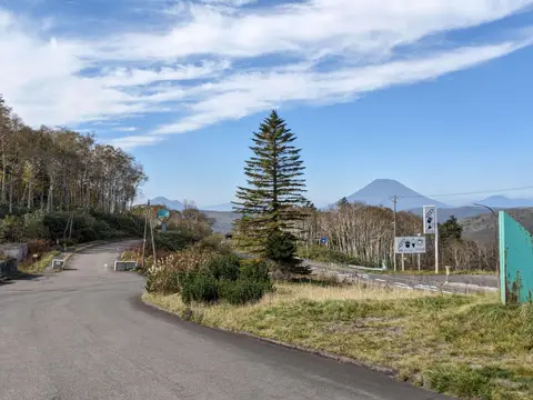
At the top of the Nakayama Pass, about an hour and a half from Sapporo, this roadside station is where most people first see Mt. Yotei. Its name, Boyo, even means "looking at Yotei." It is still far away here, but it is a good place for a toilet break and a look at what is coming.
The best viewpoints around Mt. Yotei
Aikawa Viewpoint Parking: the road to the mountain
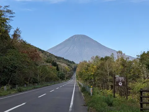
This is the view I would drive to if I only had time for one. On Route 276 in Kimobetsu, the road runs dead straight toward Mt. Yotei, and the mountain sits at the end of it like a picture in a frame. Turn right onto Route 276 at the Aikawa intersection just before the Kimobetsu town park, and the small car park is about 2 kilometers on.
There is room for only about nine cars and there are no toilets, so use the roadside station or a convenience store before you come. Do not stop on the road itself for photos; the traffic is fast here.
Kyogoku Fukidashi Park: spring water and a coffee
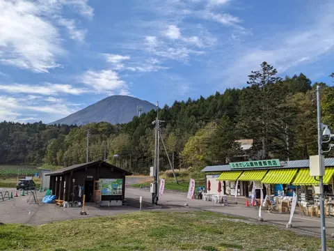
From Aikawa it is 10 to 15 minutes north to Kyogoku, and the mountain stays in front of you the whole way.
In Kyogoku, rain and snow that fell on Mt. Yotei come out of the ground as the Fukidashi spring, chosen as one of Japan's 100 best waters. The roadside station Meisui no Sato Kyogoku sits next to it: cross a suspension bridge from the car park and walk through the trees to where the water pours out. Back by the car park, a small coffee stand makes cold-brew coffee with the spring water, and you can drink it looking at the mountain. The car park is free and holds about 100 cars; in winter the station closes on Wednesdays.
Noka no Sobaya Yoteizan: the mountain in a pond
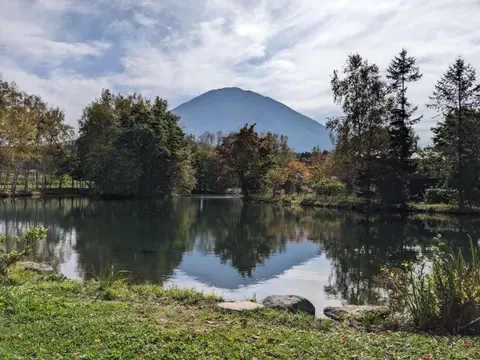
Ten minutes west of Kyogoku, this farm soba restaurant makes its noodles from buckwheat it grows itself and water from the mountain. Behind the restaurant is a pond, and on a still day Mt. Yotei is reflected upside down in it, the view locals call "reverse Fuji." I had the tofu soba made with 100% buckwheat and a bowl of rice with freshly grated wasabi; for the clearest taste of the noodles, order the plain cold seiro soba.
It is open from 11:00 to 15:30 from April to November and until 14:30 in winter, and closed on Wednesdays and Thursdays. Parking is in front of the restaurant.
If it is full, Kitchen Narita, about a kilometer further along the same road, serves venison curry with a croquette made from local potatoes, and its windows look out at the mountain. It is open only at lunchtime, from 11:00 to 14:00, and closed on Sundays and holidays; when I went, you ordered and paid at the counter, in cash. It posts holiday closures on its Instagram.
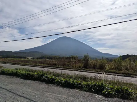
Takahashi Dairy Farm: the view from Niseko
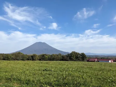
On the Niseko side, Takahashi Dairy Farm sits on a slight rise at the foot of the Niseko mountains, so you look across open pasture to Mt. Yotei on one side and up at Mt. Niseko-Annupuri on the other. You cannot go into the farm itself, but its workshops sell sweets, baumkuchen, yogurt and other dairy products made with its own milk, and the restaurant cooks with that milk and vegetables from around the mountain. It has three free car parks with room for about 230 cars.
To get here from the soba restaurant, I went up the Niseko Panorama Line, a mountain road through the Niseko range with views down over the town, and came back down past the steaming Oyunuma pond. The road closes in winter.
Makkari Onsen: Mt. Yotei from the bath
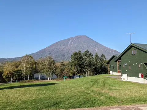
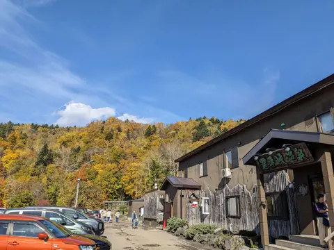
On the south side, in Makkari village, this public hot spring has an open-air rock bath that faces the mountain head-on, close enough to see the trees on its slopes and the gullies cut by old eruptions. The water is a little cool, so you can stay in and look for a long time, and there is a sauna with a cold bath. It costs only 600 yen.
It is open from 10:00 (11:00 from October to March) to 21:00 and closed on Mondays. My guide to onsen near Sapporo compares it with the other hot springs worth a drive.
 Onsen Near Sapporo: A Local's Guide to Day-Trip Hot SpringsThe best onsen near Sapporo for a day trip, chosen by a local who has bathed at all of them: Jozankei, Lake Shikotsu, Noboribetsu, Shakotan and Lake Toya, with prices, tattoo-friendly and private baths, and shuttle buses.
Mt. Yotei from Lake Toya
From Lake Toya, Mt. Yotei rises to the north, beyond the lake and the fields, and it is one of the reasons the lake is so photogenic. If you are visiting Lake Toya, these stops give you the mountain without a separate trip.
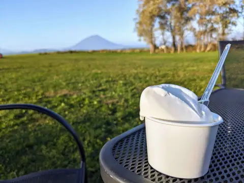
- Lake Hill Farm makes gelato with milk from its own farm. It sits on a rise, and the meadow behind the shop runs toward Mt. Yotei; in summer there are tables outside. It is open every day, until 18:00 from late April to September and until 17:00 the rest of the year.
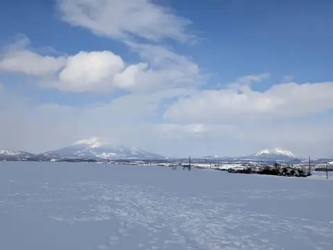
- Silo Observatory, a few minutes north, is the best-known viewpoint on the lake. Its main terrace looks south over the lake, and a separate deck to the left of the shop faces Mt. Yotei.
- Roadside Station Toyako, also on the north side, has an observation deck over the lake, and Mt. Yotei is on the other side.
From Nakajima Island
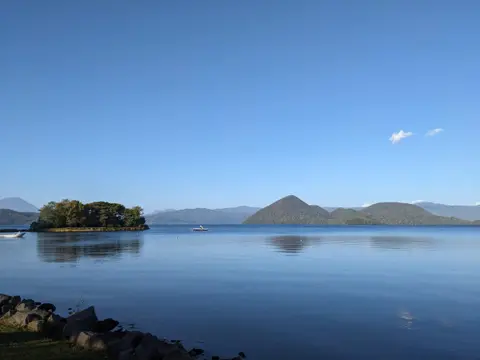
The cruise boats from the hot spring town head out to Nakajima, the islands in the middle of the lake, with Mt. Yotei behind them and seagulls following. From late April to the end of October you can land on Oshima, the largest island. From the forest museum by the pier, a trail climbs through larch woods, and after 20 to 30 minutes it drops into Daiheigen, an open meadow ringed by ridges, with Mt. Yotei visible through a gap. It feels cut off from everything, an island inside a lake.
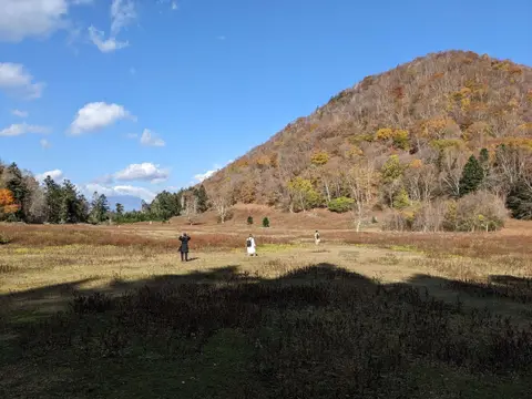
The cruise costs 1,800 yen for adults, cash only, and takes about 50 minutes; in summer the boats leave every 30 minutes, and you can take a later one back. There are no toilets on the trail, so use the ones in the museum. My Lake Toya guide has the cruise, the viewpoints and where to park.
 Lake Toya Day Trip from Sapporo by Car: A Local's Route, Viewpoints and OnsenA local's day trip from Sapporo to Lake Toya by car: Mt. Usu, a lakeside lunch, an onsen with a lake view and the quiet viewpoints on the north shore, with tolls, parking and winter tips.
A one-day Mt. Yotei loop from Sapporo
This is the order I drove, leaving Shin-Sapporo at 8:00 and getting back at 19:30. It sees the mountain from the east, north, west and south.
| Time | Stop |
|---|---|
| 8:00 | Leave Sapporo |
| 9:35–9:50 | Roadside Station Boyo Nakayama |
| 10:15–10:25 | Aikawa Viewpoint Parking |
| 10:35–11:00 | Kyogoku Fukidashi Park |
| 11:10–12:00 | Lunch at Noka no Sobaya Yoteizan |
| 12:30–13:30 | Niseko Panorama Line, Goshiki Onsen and Oyunuma |
| 13:50–14:30 | Takahashi Dairy Farm |
| 15:00–17:00 | Makkari Onsen |
| 19:30 | Back in Sapporo |
It is a long day, with five to six hours of driving in total. If you are staying in Niseko or at Lake Toya, the same stops make a relaxed half day.
When to see Mt. Yotei
The mountain is beautiful in every season: green with a dark cone in summer, ringed by autumn colors in October, and white from top to bottom in winter. The summit is often hidden by cloud, so check the weather and plan to see it in the morning if you can; the photos in this guide were all taken on clear autumn days.
From November to April the roads around the mountain are snowy, and the Niseko Panorama Line is closed. Stick to the main roads, and allow extra time over the Nakayama Pass.
FAQ about seeing Mt. Yotei
These are the questions people most often ask.
Q1. Can you see Mt. Yotei from Sapporo?
Not well from central Sapporo. The first clear view on the drive is from Roadside Station Boyo Nakayama on the Nakayama Pass, about an hour and a half from the city.
Q2. Where is the best place to see Mt. Yotei?
For the classic photo, Aikawa Viewpoint Parking, where a straight road runs toward the mountain. For something different, the reflection in the pond at Noka no Sobaya Yoteizan, or the view from the open-air bath at Makkari Onsen.
Q3. How do you get to Mt. Yotei from Sapporo?
By car, about two hours on Route 230 over the Nakayama Pass. From New Chitose Airport it is also about two hours, via Lake Shikotsu.
Q4. Is Mt. Yotei bigger than Mt. Fuji?
No. Mt. Yotei is 1,898 meters, about half the height of Mt. Fuji at 3,776 meters, but it stands alone in open farmland, so it looks huge from its base. Its cone shape is why it is called Ezo Fuji.
Q5. Can you see Mt. Yotei from Lake Toya?
Yes. From the north side of the lake, at Lake Hill Farm, Silo Observatory and Roadside Station Toyako, it rises beyond the fields. You can also see it from the cruise boat and from the Daiheigen meadow on Nakajima.
Q6. Can you see Mt. Yotei from Niseko?
Yes. It is the big cone across the valley from the Niseko ski slopes. Takahashi Dairy Farm is an easy place to stop and look at it.